NV Chart UK5 NV Atlas England - Thames Estuary to Gt. Yarmouth
NV Charts and navigation app England - Thames Estuary to Gt. Yarmouth UK5
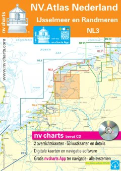
High quality paper chart with digital download app included. The UK5 NV Atlas of The Thames Estuary to Great Yarmouth is based on official data of the British Hydrographic Office (UKHO). Included in the Atlas are numerous harbour plans and details for their approaches, passages and anchorages of the area, extra details for rivers and channels with information of bridge clearances, opening times and notes and warning for the given waters. Buoys and marks are shown according to the international IKO regulation. The structure is clear making the process of finding harbour details or anchorages a swift and easy process and important navigational information accessed quickly. All information is also shown in the NV charts app included.
- 2 passage charts
- 16 coastal charts with details
- Currents for digital charts
- Tide tables and tidal streams
- NV charts app code included
- NV Atlas for the UK is published every two years
More Images

NV Chart UK5 NV Atlas England - Thames Estuary to Gt. Yarmouth
NV Charts and navigation app England - Thames Estuary to Gt. Yarmouth UK5
High quality paper chart with digital download app included. The UK5 NV Atlas of The Thames Estuary to Great Yarmouth is based on official data of the British Hydrographic Office (UKHO). Included in the Atlas are numerous harbour plans and details for their approaches, passages and anchorages of the area, extra details for rivers and channels with information of bridge clearances, opening times and notes and warning for the given waters. Buoys and marks are shown according to the international IKO regulation. The structure is clear making the process of finding harbour details or anchorages a swift and easy process and important navigational information accessed quickly. All information is also shown in the NV charts app included.
- 2 passage charts
- 16 coastal charts with details
- Currents for digital charts
- Tide tables and tidal streams
- NV charts app code included
- NV Atlas for the UK is published every two years
Product Information
Product Information
Shipping & Returns
Shipping & Returns
Description
NV Charts and navigation app England - Thames Estuary to Gt. Yarmouth UK5
High quality paper chart with digital download app included. The UK5 NV Atlas of The Thames Estuary to Great Yarmouth is based on official data of the British Hydrographic Office (UKHO). Included in the Atlas are numerous harbour plans and details for their approaches, passages and anchorages of the area, extra details for rivers and channels with information of bridge clearances, opening times and notes and warning for the given waters. Buoys and marks are shown according to the international IKO regulation. The structure is clear making the process of finding harbour details or anchorages a swift and easy process and important navigational information accessed quickly. All information is also shown in the NV charts app included.
- 2 passage charts
- 16 coastal charts with details
- Currents for digital charts
- Tide tables and tidal streams
- NV charts app code included
- NV Atlas for the UK is published every two years