🎉 Up to 70% Off Selected ItemsShop Sale

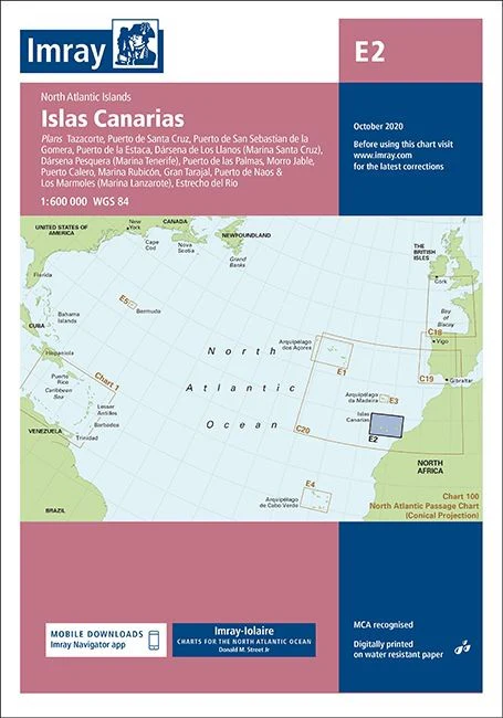
Imray E2 Chart - Islas Canarias
Imray E2 North Atlantic - Islas Canarias
The award winning Imray navigational charts allow for easy chart plotting in any conditions.
This edition of the E2 paper chart is printed and corrected to October 2020.
- Digitially printed on water resitant paper & folded to A4 size in a plastic wallet - open size: 64 x 90cm
- Chart scale 1:600 000
- WGS 84
- MCA recognised
- Detailed cartography using up-to-date official survey data, with the latest depth surveys applied
- Contains tidal stream information including direction and rates
- Includes a separate sheet of information with any symbols & abbreviations used on Imray charts
- The chart specification has been improved to show coloured light flashes
- Latest chart corrections available on the Imray website
Plans included:
- Tazacorte
- Puerto de Santa Cruz
- Puerto de San Sebastian de la Gomera
- Puerto de la Estaca
- Darsena de Los Llanos (Marina Santa Cruz)
- Darsena Pesquera (Marina Tenerife)
- Puerto de las Palmas
- Morro Jable
- Puerto Calero
- Marina Rubicon
- Gran Trajal
- Puerto de Naos & Los Marmoles (Marina Lanzarote)
- Estrecho del Rio
$32.30
Imray E2 Chart - Islas Canarias—
$32.30
More Images
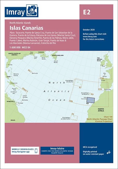
Imray E2 Chart - Islas Canarias
Imray E2 North Atlantic - Islas Canarias
The award winning Imray navigational charts allow for easy chart plotting in any conditions.
This edition of the E2 paper chart is printed and corrected to October 2020.
- Digitially printed on water resitant paper & folded to A4 size in a plastic wallet - open size: 64 x 90cm
- Chart scale 1:600 000
- WGS 84
- MCA recognised
- Detailed cartography using up-to-date official survey data, with the latest depth surveys applied
- Contains tidal stream information including direction and rates
- Includes a separate sheet of information with any symbols & abbreviations used on Imray charts
- The chart specification has been improved to show coloured light flashes
- Latest chart corrections available on the Imray website
Plans included:
- Tazacorte
- Puerto de Santa Cruz
- Puerto de San Sebastian de la Gomera
- Puerto de la Estaca
- Darsena de Los Llanos (Marina Santa Cruz)
- Darsena Pesquera (Marina Tenerife)
- Puerto de las Palmas
- Morro Jable
- Puerto Calero
- Marina Rubicon
- Gran Trajal
- Puerto de Naos & Los Marmoles (Marina Lanzarote)
- Estrecho del Rio
Product Information
Product Information
Shipping & Returns
Shipping & Returns
Description
Imray E2 North Atlantic - Islas Canarias
The award winning Imray navigational charts allow for easy chart plotting in any conditions.
This edition of the E2 paper chart is printed and corrected to October 2020.
- Digitially printed on water resitant paper & folded to A4 size in a plastic wallet - open size: 64 x 90cm
- Chart scale 1:600 000
- WGS 84
- MCA recognised
- Detailed cartography using up-to-date official survey data, with the latest depth surveys applied
- Contains tidal stream information including direction and rates
- Includes a separate sheet of information with any symbols & abbreviations used on Imray charts
- The chart specification has been improved to show coloured light flashes
- Latest chart corrections available on the Imray website
Plans included:
- Tazacorte
- Puerto de Santa Cruz
- Puerto de San Sebastian de la Gomera
- Puerto de la Estaca
- Darsena de Los Llanos (Marina Santa Cruz)
- Darsena Pesquera (Marina Tenerife)
- Puerto de las Palmas
- Morro Jable
- Puerto Calero
- Marina Rubicon
- Gran Trajal
- Puerto de Naos & Los Marmoles (Marina Lanzarote)
- Estrecho del Rio